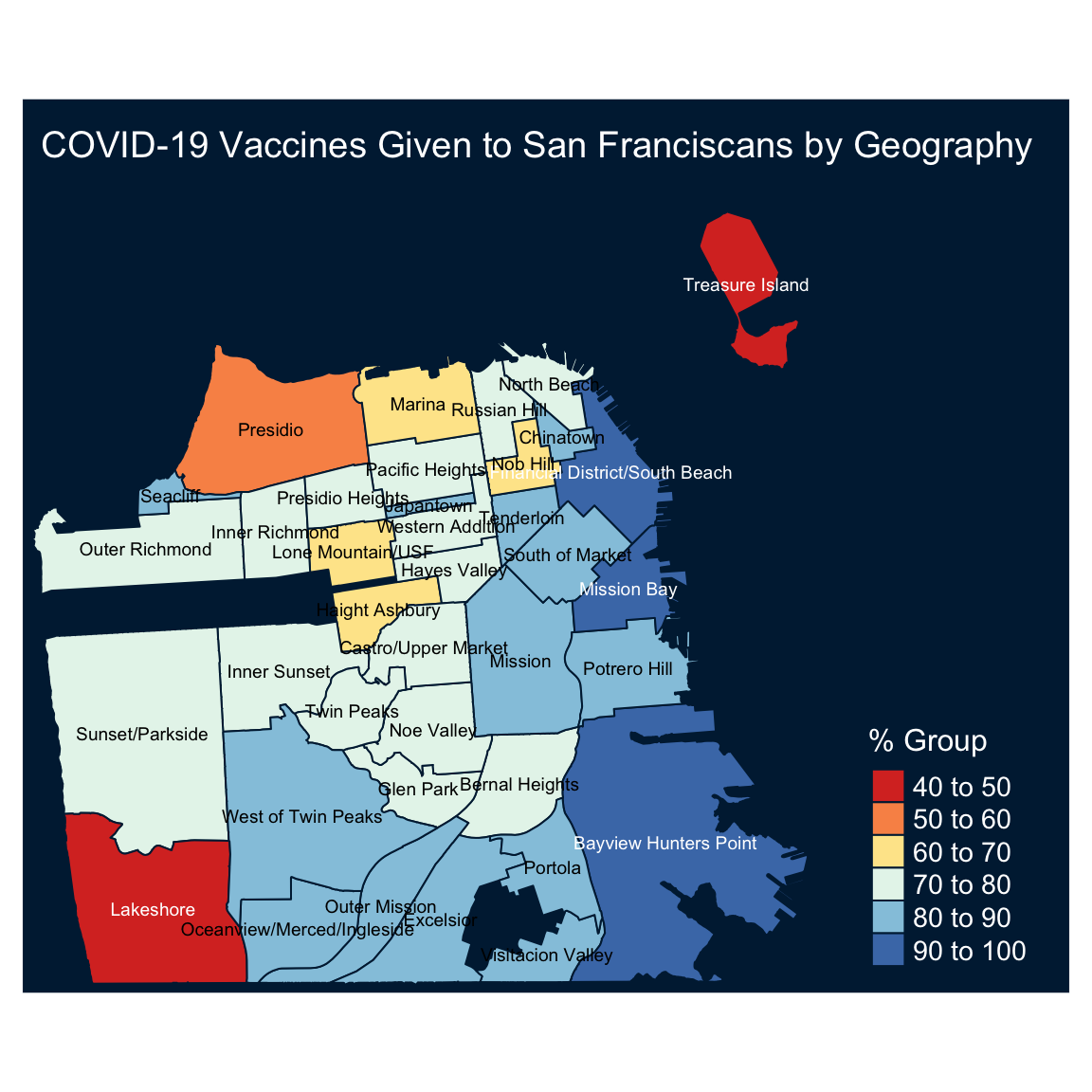
Introduction to Geospatial Visualization with the tmap package
I had super fun exploring the tmap package functionality while preparing a presentation about geospatial visualization for the Abuja R-Ladies/R Users meetup, so I decided to write a short tutorial about it.
The tmap package provides a set of functions ...